File:Solar Capacity Map.jpg
Size of this preview: 800 × 450 pixels. Other resolutions: 320 × 180 pixels | 1,920 × 1,080 pixels.
Original file (1,920 × 1,080 pixels, file size: 1.39 MB, MIME type: image/jpeg)
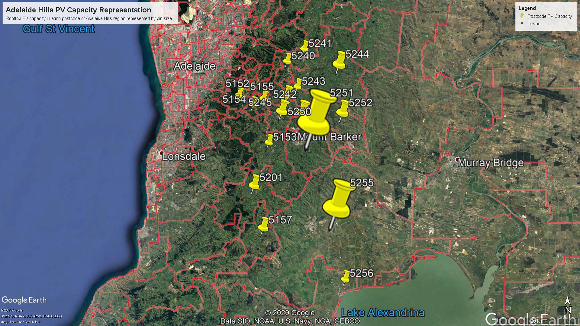
Proportional map of solar system capacities for systems of 5MW or less, in each postcode of the Adelaide Hills and surrounds.
File history
Click on a date/time to view the file as it appeared at that time.
| Date/Time | Thumbnail | Dimensions | User | Comment | |
|---|---|---|---|---|---|
| current | 10:45, 20 October 2020 | | 1,920 × 1,080 (1.39 MB) | A1706601 (talk | contribs) |
- You cannot overwrite this file.
File usage
The following page links to this file: